In a year 1943 the base for forming of a new state of Yugoslavia was formed on a federal base. Therefore it was called Democratic Federative Yugoslavia. On the type of state (weather it would be republic or monarchy) was not decided. In it both Croatia and B&H were included a federal entities. After the capitulation of axis powers in 1945 the decision was made that new Yugoslavia would be republic and it was named Federative Peoples Republic of Yugoslavia. The federal entities had names Peoples Republics of ...
In a year 1963 due to the changed political climate the new name was given to state: Socialistic Federative Republic of Yugoslavia, and federal states got names Socialistic Republic of ...
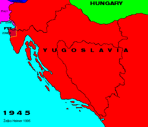
Between Yugoslavia and Italy a buffer zone was established in 1945 called Free Territory of Trieste, divided in two zones A and B. Zone A was under Allayed Military Government, and Zone B was under Military Government of Yugoslav Army. In 1953, with slight change for Yugoslavia, Zone A was given to Italy, and Zone B stayed in Yugoslavia.
Back to Previous Map. Back to Chronology list. Proceed to Next Map.
This page is maintained by Zeljko Heimer.
If you have any comments or suggestions, don't hesitate, mail me to [email protected].
Last update 10 Aug 1997.
My counter log since 04-MAY-1996.