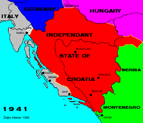
After the attack of axis powers Yugoslavia was broken up.
Slovenia was annexed directly to the Third Reich; Istra, Slovene coast, Rijeka and surroundings, islands except Pag, Brac and Hvar to Italy. Part of Dalmatian coast was also ceded to Italy by regime in Zagreb. Regions of Medjimurje and Baranya as well as Banat and Bacska were given to Hungary. In Serbia and Montenegro quisling governments were formed.
Independent State of Croatia (NDH) was declared on the territory of modern Croatia and Bosnia & Herzegovina, and including Srijem area between Sava and Danube rivers on the east.
After the capitulation of Italy in 1943 NDH reestablished authority in Dalmatia (Split and Sibenik), and Germans occupied islands and northern Adriatic.
NDH ended with other axis powers in 1945. On the other side in partisan anti-fascist movement the base for both Croatian and B&H state was formed as a federal entities in new Yugoslavia.
Back to Previous Map. Back to Chronology list. Proceed to Next Map.
This page is maintained by Zeljko Heimer.
If you have any comments or suggestions, don't hesitate, mail me to [email protected].
Last update 10 Aug 1997.
My counter log since 04-MAY-1996.