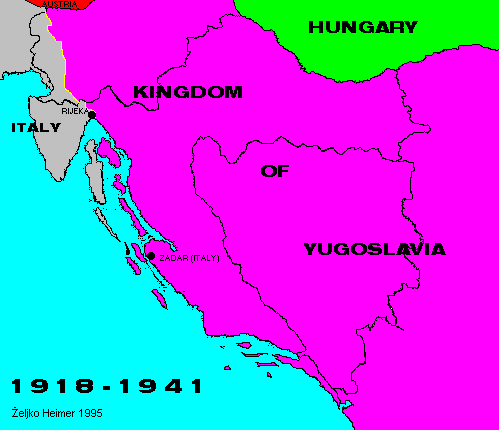

After the First Word War and peace treaties and plebiscites that flowed it, new kingdom was formed in south of Europe, kingdom of southern Slavs at first called Kingdom of SHS (Serbs, Croats and Slovenes).
Toward Austria and Hungary modern borders were established.
Toward Italy it was not so. In Italy remained whole of Istria and Slovene coast, outer islands of Kvarner, and the port of Zadar. Rijeka was at first protectorate of allies, but soon it was annexed by Italy.
Inner border in Kingdom were made to be as different form national borders as possible, to enable the homogenization of nations in it. That was also reason why the name was changed in Kingdom of Yugoslavia in year 1929.
The Kingdom was living until the attack of axis powers on 06 April 1941, when it was fragmented.
Back to Previous Map. Back to Chronology list. Proceed to Next Map.
This page is maintained by Zeljko Heimer.
If you have any comments or suggestions, don't hesitate, mail me to [email protected].
Last update 10 Aug 1997.
My counter log since 04-MAY-1996.