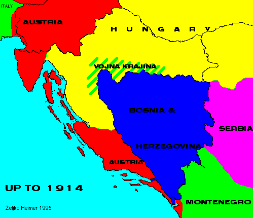
Due to the movements in 1848 Habsburg empire was formed as dual Austro-Hungarian monarchy.
Most of Croatia was a part of Hungarian half, but Dalmatia, islands and Istria were in Austrian.
Vojna Krajina was a part of Croatia under direct military government from Vienna forming a bulwark toward Ottomans. As a danger of Turks disappeared, it was slowly incorporated in Croatia.
Austro-Hungarian troops entered Bosnia & Herzegovina in 1878, and formed joint military government there. It is to note that in this time B&H was given the two corridors to the sea north and south of Dubrovnik area.
Further east and south Serbia and Montenegro gained independence from Turkey.
Back to Previous Map. Back to Chronology list. Proceed to Next Map.
This page is maintained by Zeljko Heimer.
If you have any comments or suggestions, don't hesitate, mail me to [email protected].
Last update 10 Aug 1997.
My counter log since 04-MAY-1996.