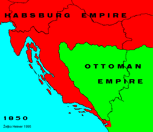
This map shows situation as in year 1850 when Austria began to issue stamps.
In the region, there were two empires: Habsburg (Austro-hungarian) and Ottoman (Turkish) empire.
The borders were mostly as between modern Croatia and B&H with minor differences, notably in south around Gnome, where B&H now have corridor to the sea, and in Boka Kotorska, the big fjord in southern Adriatic. The part of Habsburg empire was also Vojvodina, a province south and east of modern Hungary and Croatia, respectively.
Back to Previous Map. Back to Chronology list. Proceed to Next Map.
This page is maintained by Zeljko Heimer.
If you have any comments or suggestions, don't hesitate, mail me to [email protected].
Last update 10 Aug 1997.
My counter log since 04-MAY-1996.